Posts

Showing posts from November, 2012

Santiam Wagon Road: Mountain House to House Rock Falls

Image
Normally I'm somewhat apprehensive about hiking on old roads, especially ones that run parallel to a modern road. But I also love to hike any longer trails in the area. The full length of the trail portion of the Santiam Wagon Road is approximately 21 miles, running from Fish Lake to Mountain House. Some of the trail is still on drivable road, but thankfully much of it is only open to non-motorized transportation. Bridge across the South Santiam River South Santiam River  The hike starts out at a small pull out next to a gated bridge across the South Santiam River. The trailhead would hold about 5 cars, but I wouldn't expect to see many other people. Shortly after you cross the bridge you enter into an almost pure stand of Red Alder. I'm not sure what kind of disturbance caused this early successional forest, but it's beautiful.  Dense Red alder (Alnus rubra) line the trail Bigleaf maple (Acer macrophyllum) and Red alder (Alnus rubra) leaves c...

Echo Basin: Hike Among Ancient Alaska-Cedars

Image
Only being about 70 miles from home the Old Cascades region has quickly become one of my favorite areas in Oregon. Now that winter is setting in, most of the great hikes will be covered by snow. This is bad for hiking but opens the area up to low impact snow camping and snowshoe trips! The majority of the hikes in the Old Cascades are fairly short and often climb mountains. Some of my favorites are Iron Mountain and Crescent Mountain , these would be substantially more difficult in heavy snow, but with proper planning could be done. Knowing that little snow had fallen and on the advice of one of my professors at Oregon State, Caitlin and I decided to hike Echo Basin before any more snow had fallen.  Echo Basin: Rain falling Heavy rain had been falling most of the drive to the trailhead, so we had decided to park at the plowed Hackleman Old Growth Grove trailhead about .2 mile west of FR 055. When we arrived FR 055 was mostly free of snow so we drove to Echo Mountain trailhe...

Farm Well Campground: Fremont National Recreation Trail

Image
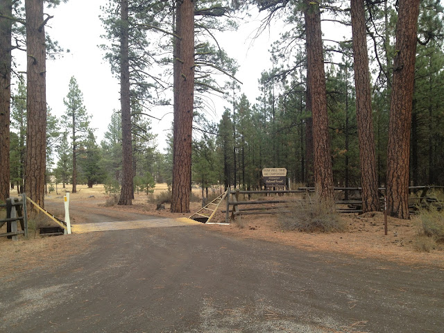
Entry to Farm Well trailhead and campground The Fremont National Recreation Trail is roughly 135 miles long and travels from Yamsay Mountain in the north to Oregon/ California boarder in the south. There are a few small gaps in the trail currently, but a thru-hike is definitely possible. I have been wanting to hike the entire length for a while now. I have a 30 day break from school coming up so snowshoeing a good portion of it is definitely possible. On this trip I wanted to figure out how well marked the trail is and to see if it would be easy to follow under a few feet of snow. And of course because it was nearly a three hour drive from Eugene, we had to camp, oh no! The well that gives Farm Well it's name Our campsite for the night at Farm Well campground and trailhead We weren't all that sure what to except from the Farm Well campground, because I couldn't find any photos of it. We were pretty excited that it was a fairly 'primitive' spot. Ha...

The Composting Adventure Pt. 2: Green Silverware from Ecnow Tech

Image
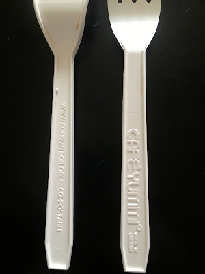
My mom and I went to lunch yesterday, something we haven't done in a while amidst all of the hustle and bustle of our equally busy lives. We didn't go anywhere super fancy, in fact, we took our food to go and ate in the car. But this post isn't about our lunch, (though if you haven't ever been to Cafe Yumm , you should try it) its about the silverware that came with our to go lunch. While stirring up my yumm bowl I noticed two things: Ecnow Tech Forks from Cafe Yumm: Made in Oregon & Compostable! My fork was made in Oregon. This alone would have been awesome, but the even more exciting discovery came from the back side of the fork. It was COMPOSTABLE! Made by Ecnow Tech , these forks are just part of a line of food service products that are not only made from recycled materials, but are compostable, made up of vegetable oil, cornstarch, and pea starch, according to the website. The top tray of our Worm Factory 360 Our worm bin has been up and running for...

Alder Springs Trail: High Desert Beauty Along Whychus Creek

Image
After coming across the Alder Springs trailhead on my map of the Crooked River National Grassland I thought it would be a good day hike that was relatively close to Sisters. After looking up some information about the area I realized that the trail is part of the proposed Whychus-Deschutes Wilderness. I was excited but a little skeptical. Given the proximity to both Sisters and Redmond I thought that it couldn't possibly have a true 'wilderness' feel, but I was wrong. Alder Springs trailhead  From that start of the drive down the rough dirt road to the trailhead I had the feeling that this hike was going to be an isolated place. There was only one other car at the trailhead and after a few minutes I wasn't sure where the other hikers disappeared to. My plan was to hike to the end of the trail were it runs into the Deschutes River. Alder Springs trail heading down to Whychus Creek Whychus Creek canyon Prior to descending to the banks of Whychus C...