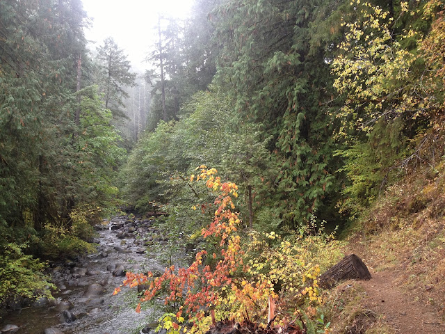
Willamatte National Forest Classic: French Pete Trail
 |
| Near the start of the French Pete Trail |
 |
| Shoes of choice: FiveFinger KSO Trek |
 |
| Impressive nurse log that spans the trail |
Though this hike connects to many other trails further upstream we only hiked a short distance past where the officially maintained portion ends, which is at the first crossing of French Pete Creek. It's a fairly straightforward hike that closely follows French Pete Creek. There are several campsites both before and after the first creek crossing. The Forest Service says that usage of this trail is high, but on the first rainy Saturday of autumn we only came across one other person. I'm sure that most of the fall and winter the trail is lightly used. If you don't mind the rain camping along the stream would likely provide solitude.
Crossing French Pete creek this early in the fall wasn't too bad, it was about nearly knee deep, but not that fast moving. If you're unsure about crossing a creek definitely don't go beyond your skill level.  |
| Fall color along French Pete Creek |
 |
| Tall and straight primarily Douglas-Fir forest |
 |
| A good friend for standing still in the cold water of French Pete Creek |
 |
| Lush green moss blankets the forest floor in this area |
 |
| Great campsite after the crossing of French Pete Creek |
Directions from Eugene: Follow Highway 126 for 40 miles east, turn right onto Forest Road 19, follow for 11 miles, trailhead is on the left at the 'French Pete Campground' sign.
Trailhead Elevation: Approximately 1,840 feet
Hike Distance: 5.0 miles according to Garmin Oregon 550 GPS
Hike Type: Out and Back
Elevation Gain: Approximately 1,000 feet
Usage: Light, only saw one other hiker
Difficulty: 1 out of 5
Fees: None
French Pete Trail at EveryTrail
EveryTrail - Find the best Hiking in Oregon


I was there the following day. I saw two people camping and one other hiker. I thought that the creek was incredibly photogenic, and I spent a very long time taking pictures at every opportunity. I only hiked to the spot where the trail crosses the creek. What is the trail like past that point? Is it similar to the beginning section in regards to creek access and photo opportunities? I've only uploaded a few pictures so far, but if you'd like to see them the gallery is at http://www.pbase.com/madhatter/oregon_2012f
ReplyDeleteThe trail past the creek crossing was somewhat overgrown. There are quite a few good spots to take photos of the creek farther up as well! Looking at your photos makes me want to head back out there this weekend. Beautiful photos!
ReplyDeleteI feel like a sunny winter day would provide some awesome light to go back shot more photos of the creek.
I guess it makes sense that the trail would be overgrown since, like me, the majority of people probably turn around where the bridge used to be. Perhaps some day I'll return and see for myself. Thanks for the info.
ReplyDeleteYes the deep canyon diffused the light wonderfully. I suspect that probably wouldn't be the case during summer.