 |
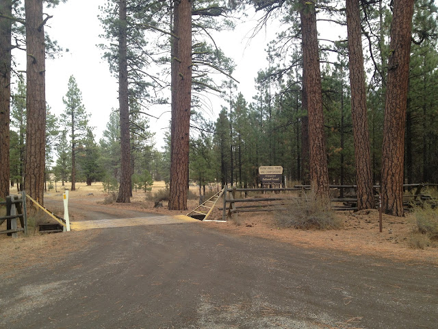
| Entry to Farm Well trailhead and campground |
The Fremont National Recreation Trail is roughly 135 miles long and travels from Yamsay Mountain in the north to Oregon/ California boarder in the south. There are a few small gaps in the trail currently, but a thru-hike is definitely possible. I have been wanting to hike the entire length for a while now. I have a 30 day break from school coming up so snowshoeing a good portion of it is definitely possible. On this trip I wanted to figure out how well marked the trail is and to see if it would be easy to follow under a few feet of snow. And of course because it was nearly a three hour drive from Eugene, we had to camp, oh no!
 |
| The well that gives Farm Well it's name |
 |
| Our campsite for the night at Farm Well campground and trailhead |
We weren't all that sure what to except from the Farm Well campground, because I couldn't find any photos of it. We were pretty excited that it was a fairly 'primitive' spot. Having one pit toilet and no running water. The forest was a mix of Ponderosa Pines and Western Juniper, most being fairly small. The campsite we picked had a few rounds left by the Forest Service and there was also several slash piles nearby, this made collecting wood unnecessary. Though it's not use to me currently, there is a fairly large usable horse corral located at the campground
 |
| Horse Corral at Farm Well Campground |
 |
| Pines on the edge of a meadow near Farm Well Campground along the Fremont National Recreation Trail |
From the campground we only walked about a mile in either direction because of limited daylight. If you're camping and want to day hike Hager Mountain would be an approximate 12 mile hike, round trip.
 |
| Ponderosa Pines along the Fremont National Recreation Trail |
It turned out that most of the trail markers were at least 6 feet above the ground and in areas without, there was orange tape around trees with 'trail' written on it. This trail would likely be easy to follow, in this area anyways. I can't wait to get back out on the Fremont National Recreation Trail. If you need a good base camp for Hager Mountain, Farm Well is a good option.
 |
| Keeping warm on a chilly night at Farm Well campground |
Directions From Silver Lake: Follow County Road 4-12 for 6 miles, turn left onto FR 2916, follow for 6 miles, large sign will be on your left.
Elevation: 5,068 feet
Fees: None
Water: None
Bathroom: One pit toilet
Trash: Pack it out
Usage: Moderate, 3 other campsites were occupied.


Nice area not used much. Just visited.
ReplyDeleteI'm glad that you had a chance to check it out.
ReplyDeleteDid you get a chance to do any hiking on the Fremont National Recreation Trail?